The name of the Sahara is Arabic, which means the greatest desert. The Sahara covers an area of 9.4 million square kilometers and occupies most of North Africa. It covers 11 countries: Algeria, Chad, Egypt, Libya, Mali, Mauritania, Morocco, Niger, Western Sahara, Sudan, and Tunisia.
The Sahara is surrounded on the west by the Atlantic Ocean. An arid, desolate, and primarily lifeless area spans from the Red Sea in the east to the Atlantic Ocean in the west. It is from the Mediterranean Sea in the north to the Sahel in the south. It covers more than 9 million square kilometers, or 31% of the continent of Africa.
Like any desert, the Sahara significantly influences life within its borders. But because of its size, the desert’s reach extends far beyond. Some of these effects are even visible from space. The atlas mountains and the mediterranean sea in the north.
The red sea is in the east, and Sudan and the niger valley area are in the south. It is disbanded into the western Sahara, the Sahara mountains, the Tibesti mountains, and the Air mountains. These areas of the desert have the highest peaks. The Libyan desert could be considered the driest region. The cities in the Sahara are mostly concentrated around the oases.
Why does the Sahara desert exist?
The Sahara Desert, located in northern Africa, is the largest hot desert in the world. The following factors primarily influence its existence:
Subtropical High-Pressure System: The Sahara is situated within the subtropical high-pressure belt known as the subtropical ridge or the subtropical anticyclone. This atmospheric system causes the region to experience persistent high-pressure conditions, resulting in stable air descending from higher altitudes. The air warms and inhibits cloud formation as it sinks, leading to minimal precipitation.
Rain Shadow Effect: The Sahara is surrounded by mountain ranges such as the Atlas Mountains to the north and the Ahaggar and Tibesti Mountains to the south. This mountain ranges act as barriers, blocking the moisture-laden winds from the Atlantic Ocean and the Mediterranean Sea. As a result, the desert lies in a rain shadow, receiving very little rainfall.
Trade Winds: The prevailing winds in the region, known as the trade winds, blow from the northeast, bringing dry air masses to the Sahara. These winds are part of the Hadley cell circulation, a global atmospheric circulation pattern that transports air from the subtropics toward the equator.
Geological Factors: Geological factors have also influenced the Sahara’s arid conditions. The region has vast sand, gravel plains, and rocky plateaus, which do not retain water effectively. The lack of significant river systems and limited underground water sources further contribute to the desert’s dryness.
Climate Change: While the Sahara is naturally arid, climate change also influences its current state. Over the past few thousand years, the Sahara has fluctuated between more and less arid periods. Human activities and natural climate variations can influence the extent and intensity of desertification processes.
Today, most Sahara is devoid of life, but this wasn’t always the case. Believe it or not, the desert cycles between periods of humidity and aridity every twenty thousand years. One of the main reasons for that is the precession of the Earth’s axis, which changes the location of the North African monsoon.
As the monsoon position shifts, Sahara’s rainfall and the desert turn green. The Sahara is going through a dry period. It has been expanding during the last three thousand years and through desertification.
- As the desert grew, it accumulated enough sand to cover the globe with a layer 20 centimeters thick.
The Sahara can generate huge dust storms because of this vast sand. Such storms can damage human health and negatively impact the economy by eroding soils and damaging crops. However, they can also have beneficial effects by enriching ecosystems.
Out of all places globally, these are probably best observed in Central and South American rainforests, which receive most of their mineral nutrients through the Sahara dust. Air currents carry it over the entire Atlantic Ocean. Looking at the size of the desert storms, you might think that the Sahara consists entirely of dunes, but this is not the case.
- The dune fields, some of which rise to 180 meters in height, only cover about 15% of the surface.
The rest consists of rocky plateaus, mountains, and large Oasis depressions. In Chad, Sahara’s highest point, mount Koussi is a dormant volcano. It stands at 3450 meters and, despite its altitude, receives little to no precipitation. Sahara’s slowest point, on the other hand, Egypt’s Qattara depression, has somewhat of a more exciting story.
- At a low point of 133 meters below sea level, several proposals have flooded the Qattara depression.
It lies within proximity to the Mediterranean Sea. It was argued that the flooding of the depression could generate power through a hydroelectric turbine while rejuvenating the surrounding desert. However, some concerns flooding the area with seawater could lead to a hypersaline lake.
That would not support a fish population or a salt pan that could build up to tens of meters and eventually fill the depression. Regardless, people remain optimistic about the plan, and it’s not difficult to understand why. Water is essential for life, and nowhere is more evident than in the Sahara.
- The desert spans eleven countries with a combined population of 300 million.
But less than 1% of them live in the desert. The areas with the highest concentration of people are near water sources, which are vital for agriculture. Growing crops elsewhere in the desert is nearly impossible, and it is very sparse where vegetation manages to survive.
On top of that, large regions of the desert are hyper-arid and often receive no rain for years. However, despite the lack of rain, the Sahara still contains vast amounts of fresh water from its humid period stored in large sedimentary aquifers deep beneath the surface.
In recent years people have found a way to tap into that water, the result. Each about a kilometer across, these crop circles are visible from space and symbolize human ingenuity’s success in the harshest conditions. The shape of the crop circles results from an efficient center-pivot irrigation system, which draws water from the Nubian aquifer.
- According to estimates contains 150,000 cubic kilometers of water.
The solution is unlikely to turn the whole Sahara into arable land. The problem with fossil water is that it is a non-renewable resource. As such, its increased usage would only result in its faster depletion. This, in turn, would make life impossible for people who rely on it for survival.
How did Sahara become a desert?
About 6,000 or 8,000 years ago, the Sahara was completely covered in grass. It was a luscious grassland with much vegetation and a wet climate. Earth is tilted, which changes the climate. Due to the moon, it was tilted from about 22 to about 25 degrees. It’s from about 20 to 25 degrees every 40,000 years or so.
About 8000 years ago, it changed from approximately 24.1 degrees to 23.4 degrees. So the Sahara region did not receive as much light anymore. This particular region’s middle of summer received quite a lot of light. It was easier for vegetation to roll here, and because the vegetation grew so much, this also increased the number of monsoon rains.
Vegetation retained a lot of moisture and released it into the air creating even more rain. So it was like a cycle. However, as the temperature decreased, it got to where the monsoon started to die out. This vegetation started to dry out as well. After about twenty to thirty thousand years, it will again receive a lot more sunlight and chances for this region to be full of vegetation again.
The tremendous weight helps the speed of the earth’s tilt that the northern and southern poles create due to the ice. As the ice cap started to melt, specifically in Greenland, many ice caps started to melt. As these ice caps began to melt, all the water was distributed into the rest of the oceans.
So the northern and southern poles started losing much of their weight. In other words, the natural tilting effect has accelerated and, because of this, will be experiencing more seasonal changes even more frequently.
It has a tremendous effect on weather, specifically on the rain monsoon. That may increase the desertification of other regions. It might not provide enough time for various areas to replenish the vegetation. Climate change creates a mountain of caps to shift the planet’s weight, tilting the axis even faster.
Climate of Sahara
The climate in the Sahara is extremely harsh. In the warmest months of the year, the temperatures regularly exceed 58 degrees Celsius, over 122 degrees Fahrenheit. The average annual temperature is around 30 degrees Celsius, 86 degrees Fahrenheit. Due to insufficient humidity, there are large temperature differences between day and night. So at night, the temperatures regularly go below zero. That’s cold.
- The northeastern parts of the Sahara are characterized by strong winds that reach hurricane speeds and often cause sandstorms.
- The central part of the Sahara has almost no precipitation. It’s the driest area of the entire desert, with almost no vegetation.
- In the mountains, precipitation is more abundant, and temperatures are lower.
These so-called winds that blow up to a hundred kilometers per hour are responsible for North Africa’s dry and warm climate. The Sahara is mostly an arid area, and almost half of the Sahara has rainfall of two centimeters per square mile. The rest is up to 10 centimeters per square mile. Unpredictable rains are usually very abundant and create torrents.
Flora in the Sahara
The central parts of the Sahara generally have poor vegetation. The northern and southern parts of the desert and the plateaus have sparse grass and desert bushes with occasional trees. It is estimated that about 500 plant species grow in the Sahara. These plants resist high heat and low humidity but survive in saltwater environments.
- Alexander, Tamarisks, Myrtles, Acacias, and palm trees can be found in the mountains.
These plants grow close to the ground and are adapted for the best water use. But also store it inside, usually through thick leaves or thorns, to prevent water from evaporating.
Animal World in the Sahara
Thousands of years ago, the Sahara had enough water and solid living conditions for various animals and people. Evidence shows that crocodiles lived in rivers and caved in prehistoric drawings found in Sahara. The giraffes, elephants, cattle, and lions lived in the Sahara.
Today there are no living conditions in a large area of the Sahara. Exceptions are the Nile Valley, several oases, and plateaus north of the desert where olives can be grown. The changes occurred some 1,600 years before Christ.
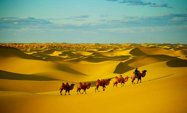
Due to the earth’s axis, it increased temperature and decreased precipitation. They are estimated to be about 70 animal species in the Sahara. Camel animals that symbolize the Sahara were brought to the Sahara around 200 AD. Their resistance to harsh conditions proved a significant advantage over the replaced horses. Due to their soft feet, camels move quickly through the sand and can last up to 17 days without food or water.
The desert climate suits some animals, such as snakes, scorpions, and rodents. The Sahara is a suitable habitat for poisonous scorpions and snakes and is home to over 40 species of rodents.
- Hyenas, jackals, African wild dogs, and the Sahara cheetah are the most dangerous carnivores in the Sahara.
In the northern Sahara also lives the phoenix fox, characterized by its large ears. During the day, she stays in tunnels dug in the sand, and she goes out and hunts for rodents at night. Desert crocodiles even live in parts of Chad. Nomadic tribes keep camels and goats and are the only domestic animals in the desert.
More Articles:
Why Does Europe Have No Desert?
How Did Plants Evolve Into Carnivorous?
The Seasons To Change On Earth
Why Doesn’t Moon Fall On The Earth Surface?
References:
“Detection and Analysis of an Amplified Warming of the Sahara Desert.” Journal of Climate.
“Is the World Full or Empty?”. Story Maps. Story Maps.
“Sahara.” Online Etymology Dictionary. Douglas Harper, Historian.
“English-Arabic online dictionary.”
A Dictionary of Modern Written Arabic (Arabic-English) (4th ed.).
“A “pacemaker” for North African climate.”
“Sahara desert.” Terrestrial Ecoregions. World Wildlife Fund.
Ecophysiology of Economic Plants in Arid and Semi-Arid Lands.
Table of Contents