
Rivers carry astonishing amounts of water, but where does all that water come from? Do you think that it probably comes from the rain? But why is there water in the rivers even when it is not raining? Only relatively few drops fall in rivers even when it rains. Most rain falls directly into the oceans, and the rest mainly falls on the ground or vegetation.
Moreover, part of the rain evaporates and returns to the atmosphere very quickly, but also evaporates quite quickly. There is a small amount of rain that remains. Especially when it rains, some water will run off the surface, slide down the slopes, and finally collect in rivers.
How does a river form?
The formation of a river typically involves several stages as it evolves and develops over time. Here are the general stages of river formation:
Stage 1: Youthful Stage or Rill Stage
In the initial stage, precipitation leads to the formation of small channels known as rills. The concentrated water flow over the land’s surface forms these narrow and shallow rills. They tend to occur on sloping terrain and are often temporary, appearing after rainstorms and disappearing as the water evaporates or infiltrates the ground.
Stage 2: Youthful Stage or Gully Stage
As rills erode the soil, they can grow larger and deeper, forming gullies. Gullies are deeper channels compared to rills and have steeper sides. They develop due to increased runoff and the concentration of water flow in specific paths. Gullies can further deepen and widen, carrying more water during heavy rainfall.
Stage 3: Mature Stage or V-Shaped Valley Stage
Gullies can develop into streams with further erosion and continuous water flow. Streams in this stage have a distinct V-shaped profile. The water flows into the land, creating a deeper, narrower channel. The river’s energy primarily focuses on downward erosion as it erodes the bedrock or sedimentary layers beneath it. The river exhibits increased meandering and signs of lateral erosion, widening the valley over time.
Stage 4: Old Stage or Meandering Stage
In the meandering stage, the river has a well-developed meandering pattern with curves and bends. The river erodes the outer bank of the curves through erosion and deposits sediment on the inner bank. This leads to the gradual shifting of the river channel over time. Meanders become more pronounced, and the river may form oxbow lakes if the bends are cut off from the main channel. The river continues to erode vertically, deepening the channel.
Stage 5: Mature Stage or Braided Stage
In some cases, rivers enter a braided stage characterized by multiple interconnected channels. Braided rivers occur when a high sediment load is transported by the river, forming numerous small channels that weave through a wide floodplain. These shallow channels change their course frequently due to sediment deposition and erosion patterns.
Stage 6: Old Stage or Delta Stage
As the river approaches its mouth, it may enter the delta stage if it flows into a large body of water, such as a sea or ocean. Deltas form when the river’s velocity decreases, and it deposits sediment at its mouth, forming distributaries and a fan-shaped landform. Deltas are dynamic and can evolve over time as the river deposits sediment.
Rivers form through a complex process known as the water cycle, which involves the continuous movement of water on, above, and below the Earth’s surface. Here is a simplified explanation of how rivers form:
Precipitation: The water cycle begins with precipitation, which includes rain, snow, sleet, or hail. When it rains, water falls from the atmosphere onto the land’s surface.
Runoff: Once the precipitation reaches the ground, it seeps into the soil (infiltration) or starts flowing over the surface (runoff). Runoff occurs when the ground is saturated or precipitation exceeds the soil’s absorption ability.
Channel Formation: As runoff water flows downhill, it follows the least resistance path, forming small channels or rills. These channels can merge and grow in size as more runoff water flows through them.
Stream Formation: When the runoff channels become larger and more defined, they are called streams. These streams flow in a specific direction and continue to erode the land, deepening and widening their channels.
Confluence: Streams often merge with other streams, forming larger bodies of water. These merging points are called confluences. As streams combine, they form rivers.
River Development: Rivers continue to flow and grow in size as they receive more water from tributaries (smaller streams that flow into the main river). Over time, they develop distinct features such as meanders, floodplains, and riverbanks.
River Systems: Rivers are part of larger river systems that include a network of tributaries, which ultimately drain into larger bodies of water such as lakes, seas, or oceans.
A river is a naturally flowing watercourse, usually freshwater flowing towards an ocean, sea, lake, or another river. River forms from water flowing from higher to lower elevations due to gravity. Most rivers originate high up in the mountains. The place where a river originates is called the source of the river. When glaciers melt due to the sun’s heat, it turns to water and flows down the mountain in small streams, gradually forming a river.
Rain also plays a role in the formation of rivers. When rain falls on the land, it either seeps into the ground or becomes runoff, flowing downhill into the rivers. In comparison, rivers try to find the quickest way toward the sea. Due to the pressure and force, the fast-flowing river erodes the riverbank and soil and takes it with it.
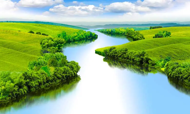
Rivers form snake-like patterns as they flow across the fairly flat valley floors. The fast-flowing side of the river erodes comparatively more than the slow side of the river. Therefore more sediments get deposited on the slow side resulting in the land on one side. On the other side, water-creating loops are known as meanders.
All the rivers and streams start at some high point. These streams slowly join together to form larger streams. Eventually, all this water forms rivers and runs into the ocean. A river enters the sea, ocean, or lake and is called its mouth.
From the river’s source to its mouth, the forces of moving water erode and shape the land. We call the action of flowing water on fluvial land processes. Fluvial processes can be broken down into three main components: erosion, transportation, and deposition.
For example, a river such as the Yangtze begins its 6300-kilometer journey as meltwater from the glaciers on the Qinghai-Tibet plateau, where mountain sediment erodes. As a river winds eastward across China, it erodes, changing the landscape and transporting more material. Eventually, the river reaches the sea, where the material is deposited in the Yangtze River Delta.
EROSION
Moving water in the form of rivers is an agent of erosion. River water wears away rocks and soil found on the riverbed and banks. Rock particles carried downstream continue to break down further as the river transports them. There are four primary forms of fluvial erosion.
Hydraulic action: The force of river water against the banks can cause air to be trapped and pressured into cracks in the rocks on the riverbank. This continual pressure causes the rocks to crack further and eventually break away.
Abrasion: As the river transports rocks downstream, these rocks wear down the material on the riverbed.
Attrition: Attrition is where the rocks and pebbles being carried by the river smash against each other, breaking each other down into smaller, rounder, smoother pebbles.
Solution: Solution or corrosion is the chemical erosion of the rocks of the riverbank. Water is slightly acidic, especially where streams flow through rocks like limestone.
TRANSPORTATION
Once it has been eroded, material in the river is transported downstream. It depends on the interaction between a river’s velocity and particle size. As a rule, the larger the particle size, the higher the velocity of moving water required to transport it. When the river’s course is steep, often near its source, velocities are higher, enabling the transportation of large rocks and boulders. During times of flood, energy levels will be even higher.
Transportation takes place in four ways:
Solution: This is where the smallest particles of minerals are dissolved in the water. This usually happens in a river’s middle and lower reaches as it takes some time for the material to be dissolved.
Suspension: Small particles are carried along the river. This can take place anywhere along the course of the river.
Saltation: Small pebbles bounce along the riverbed. It mainly takes place in the upper and middle sections of the river.
Traction: This is where large boulders and rocks are rolled along the riverbed.
This mainly occurs in the river’s upper reaches as it is the only place where energy is high enough to do so.
DEPOSITION
When a river loses energy, it will deposit some of its load. Energy levels are lowest when rivers meet the sea or lake and slow down, causing deposition. Deposition features such as deltas can form in these places. The deposition also occurs when the volume of water decreases. It happens at the end of a flood or during a drought. For example, the slower-moving water inside a river’s bend will have less energy and therefore drop its load, helping to create a meander.
A major deposition feature is the flood plain in its lower reaches. It is made up of deposited sand and silt, known as alluvium. Therefore, floodplains are very fertile and have supported large agricultural communities since ancient times.
RIVER PROFILES
The long profile is a slice through the river from the source to the mouth, as seen in this diagram. Rivers are essentially trying to erode to their base level. That is usually sea level or sometimes a lake that the river may drain into. It is because, without the force of gravity, water will not flow.
Near the river’s source, often high in the mountains, a river will cut vertically to form a steep v-shaped valley. A river often flows through rapids and waterfalls in these mountainous environments. As rivers reach their mid-course, they continue to cut downwards and laterally.
Finally, rivers flow over flat land like a river near the sea. Most of the river’s energy is concentrated on cutting laterally and making the channel wider as it meanders toward the river’s mouth. The cross profile of rivers also changes.
Where does a river start and end?
A river typically starts at its source and ends at its mouth, flowing into another body of water. Here are the key terms associated with the start and end points of a river:
Source: The source of a river is the point where it originates. It is in highland areas such as mountains, hills, or plateaus. The source is usually fed by springs, melting snow, or rainwater runoff.
Headwaters refer to the initial streams or small tributaries that flow from the river’s source. These small watercourses merge to form the main river channel.
Confluence: A confluence is a point where two or more rivers or streams meet. It is at the confluence that smaller tributaries join the main river. The confluence can occur at any point along the river’s course, contributing to its overall flow and size.
Mouth: The mouth of a river is the endpoint where it discharges its water into another body of water, such as a lake, sea, or ocean. At the mouth, the river’s water often slows down and spreads out, forming a wider channel or a delta in some cases.
Some rivers may terminate in inland areas, such as deserts or endorheic basins, where water evaporates or percolates into the ground without reaching the ocean or a significant water body.
Source of river water
Some rivers may develop over thousands of years, while others, particularly those formed in mountainous or rapidly eroding regions, may form more quickly. It is a dynamic process that occurs over extended periods and shapes the landscape throughout geological time. The size of the drainage basin, also known as the watershed, determines the amount of land area that contributes water to the river.
A larger drainage basin collects more water, resulting in a larger river and higher flow. There can be water in rivers even weeks after the last rains. So, where does that water come from? It turns out that, especially in winter, when less water evaporates through the plants. Some rainwater can infiltrate into the soil. But what happens when the water infiltrates downwards and reaches the rocks under the topsoil? Well, It depends on what type of rock it finds.
Some rocks contain a lot of small holes, even though they are sometimes so small. These little holes are called pores, and rocks with many pores are said to be porous. When the rocks are porous, water can seep through the holes and continue its journey downward. But some rocks have very few pores. In this case, the rocks are impermeable because water cannot pass through them. If a layer of impermeable rock blocks the downward passage of water, water begins to collect in the porous rocks above.
This way, it can form large underground reservoirs of water known as groundwater aquifers. The water table is the uppermost level in which the pores contain water. Rocks between the water table and the aquifer base can contain more than 20% of their volume of water. It means more than 200 liters of water can be stored in each cubic meter of rock. A cubic meter is more or less the size of a fridge.
The water can no longer infiltrate downward when it reaches an impermeable layer. So it slowly moves, more or less following topography towards places where the water table is the lowest. In some places, the water table might come to the surface. In this case, the water can come underground and return to the surface. In this way, the rivers receive a lot of their water.
The water table level rises and falls with the rain and the seasons. But as long as the level does not drop lower than the river bed, water will seep up through the river bed. Also, the river can continue to flow even when it is not raining. But that’s not all. Many rivers start high in the mountains, with snow and ice covering the peaks.
These rivers receive a lot of water in spring and summer, which forms when snow and ice melt. For this reason, in the Alps, there is often much more water in rivers in summer than in winter.
- Some of the water reaches the river as surface runoff when it rains.
- Some of the water comes from groundwater reservoirs.
- Finally, some of the water comes from melting snow and ice.
The Nile River is the longest river on earth. It measures around 4132 miles. It runs through or along the border of 10 other African countries. Over vast periods the primitive oceans formed. The water remained gas until the earth cooled below 212 degrees Fahrenheit. About 3.8 billion years ago, the water condensed into rain, filling the basins known as our oceans. We have five oceans that are all connected, namely, the.
- Arctic Ocean.
- Southern Ocean.
- Indian ocean.
- Atlantic ocean.
- Pacific ocean.
Near the source, river channels are narrow and shallow due to the steepness of the terrain. Rivers in these environments contain many large boulders and rocks. With all the sediment on the riverbed, much turbulence and friction slow the water down. When the river has reached this lower course, it flows fastest until it slows down to meet the sea. The channels are deep and wide here, and the banks are the smoothest.
More Similar Articles:
Why Do Rivers Meander Or Curve?
Why Do Most Rivers Flow South?
Why Do Rivers Flow In One Direction?
How Do Ocean Currents Affect On Climate?
What Drives The Ocean Currents?
References:
Hawkes, H.A., River zonation, and classification. River ecology. Blackwell. pp. 312–374.
Cave, Cristi. “How a River Flows.” Stream Biology and Ecology.
Rosenberg, Matt, “Do All Rivers Flow South?”.
Table of Contents
