
Hello, intrepid explorers of the natural world! Have you ever stood atop a mountain, with the wind in your hair, and marveled at the sprawling landscapes below? Or perhaps wandered along a riverbank, pondering how these waters have shaped the land over millennia? Physical geography is the key that unlocks the stories of these landscapes, the movements of our oceans, and the patterns of our climates.
The Earth is a super dynamic place. Some changes happen slowly, like the continents drifting or the Rocky Mountains growing. But a storm or avalanche changes the landscape in the blink of an eye. Both types of change have a tremendous influence on lives. These changes are part of the physical geography above and below the Earth’s surface.
The landscape isn’t permanent. It’s changed as continents have shifted and humans have interacted with the environment. It will continue to change. The Earth has a story that extends back over 4.5 billion years. Many maps and borders represent modern geopolitical divisions. Many geographical place names also don’t reflect the Indigenous or Aboriginal people’s languages.
We’re going on an exploratory journey into the heart of physical geography, a science that paints the portrait of our planet’s physical features and the processes that sculpt them. From the highest mountain peaks to the deepest ocean trenches, we’ll discover how Earth’s surface is constantly being reshaped and transformed. Are you ready to traverse this fascinating terrain and uncover the secrets of the physical world? Let’s set out on this adventure together!
What is Physical Geography?
The Earth is a big and complex place. Geography is the study of the relationship between humankind and Earth’s space. Traditionally, geography is studied as two interconnected parts: physical geography and human geography. Physical geography is about recognizing the environment’s characteristics and the processes that create, modify, and destroy those environments. Remember, human-environment interactions are fundamental to studying geography.
As physical geographers, we’ll look for answers to our questions about the processes that happen without humans and because of humans. The geo-ecosphere is the narrow zone on Earth’s surface. It contains all the different landscapes and major systems interacting to create our dynamic planet.
By breaking the Earth into distinct systems, we can look for connections that help us understand complex problems like climate change or the loss of various life in different habitats.
In physical geography, there are four major Earth systems.
- Atmosphere.
- Hydrosphere.
- Lithosphere.
- Biosphere.
First, the atmosphere, or the layers of air surrounding Earth, gives us clouds, weather, the ozone layer, and the air we breathe. Then there’s the hydrosphere, or all the water on, below, or above the planet’s surface. So all the water in the soils, under the ground, in oceans, lakes, ice caps, streams, plants, animals, our bodies, and all the water molecules in the atmosphere!
The lithosphere is the rocky outermost layer of Earth. The rocks of the lithosphere form our continents and line the bottom of Earth’s oceans. Finally, the parts of Earth where life can exist make up the biosphere, whether a deep, dark, cold spot in the ocean, a barren mountaintop, or a lush, fertile farm field. All four spheres will play a role. Like ecosystems, communities of living things interact in concert with their nonliving environment based on these underlying Earth systems.
Off the northeastern coast of what we know, Australia is the world’s largest coral reef: the Great Barrier Reef. Almost 3000 individual reefs are home to more than 9000 species of tiny, fragile, yet resilient organisms working together to build their home. Since the Great Barrier Reef is life, the reef is part of the biosphere. The coral itself builds even the skeleton of each reef.
The Great Barrier Reef’s hard corals secrete the chemical compound calcium carbonate, which hardens into limestone. That limestone is part of the lithosphere and forms the rock foundation that protects the corals and other organisms from the waves. The limestone remains even when the coral dies, becoming a spot for new coral to grow and thrive.
The Great Barrier Reef exists in the Pacific Ocean underwater, so the hydrosphere surrounds it. The atmosphere still interacts with this marine ecosystem through storms! These delicate-looking coral reefs are most successful in areas where the hydrosphere and the atmosphere clash, creating many waves.
It’s estimated that thousands of cubic kilometers of ocean water flow through the Great Barrier Reef each year. It brings food oxygen and moderates temperatures for the reef’s living organisms.
Clashes between the atmosphere and hydrosphere can become destructive, though. All four spheres are involved when Pacific cyclones’ high winds and towering waves destroy softer corals and damage hearty corals. But cyclones bring cooler water into these shallow ecosystems and clean up the reef by whisking away sediment built up over time.
The Earth’s atmosphere, hydrosphere, lithosphere, and biosphere are driven and influenced by the Sun or incoming solar radiation. For example, the Sun’s energy heats liquid water, causing it to evaporate into water vapor. That water vapor may condense in the atmosphere, forming clouds and rain.
That rain may enter a river or a lake or become frozen in a glacier. Over time, that glacier might move down a mountainside, altering Earth’s surface and providing a habitat for the smallest bacteria.
The topography, or shape of the land, results from processes happening above and below the surface. From time to time, lava spills out from fissures in the crust. It means Iceland is still growing! If we “dig in,” we’d find most soils in Iceland are volcanic soils called andisols. These soils form from volcanic ash and are super rich in nutrients.
About 1000 years ago, settlers cut down many of the forests. Cattle and sheep grazing became possible year-round, leading to overgrazing that ultimately exposed the rich topsoil to erosion. So there’s a lot less nutritious soil for plants these days.
Branches of Physical Geography
Physical geography is divided into several branches or related fields, as follows:
Geomorphology: Geomorphology studies landforms landscapes and the processes that create them. There are plenty of variations on that definition in the literature. Studying great landscapes and applying that to practical needs, especially in global change.
So, it’s easy to identify many ways in which geomorphology is essential. For example, understanding landscapes helps us enjoy them more to predict and identify them. Structural geomorphology is geological control that strongly influences landscapes or processes.
Pedology: Pedology is the study of soil types and how they form. Pedologists have helped with extensive soil conservation efforts for over a century. The rare combination of glaciers and volcanoes influences the land and water.
Glaciology: It is the scientific study of glaciers and their effects on the landscape.
Climatology: It is a collective state of the atmosphere science, like weather forecast, temperature, wind, relative humidity, barometric pressure, etc. Climatology is taking a look at weather over a long period. Climate and weather are energy in one form or another. The source of energy is solar radiation.
Biogeography: It is the study of geographical distribution. Biogeography provides excellent evidence of evolution and strong evidence to reject creationist ideas of a 6-10 thousand-year-old earth.
Oceanography: Science studies the oceans, including the actual oceans. It is concerned with coastal environments and organisms that live inside of them.
Meteorology: It is the study of the atmosphere and everything that happens on the surface. It guides weather systems from day to day.
Paleogeography: It is the study of geography in the geologic past. Throughout art history, the continents have moved, mountains have risen, eroded sea levels have fluctuated, etc. It says how geographic changes affect organisms. For example, the Jurassic theropod dinosaur fossils have been found in North America and Portugal.
Hydrology: Hydrology studies how water is moved, managed, and distributed above and below Earth’s surface, like rivers, lakes, oceans, and groundwater.
About 10% of Iceland is covered in icy glaciers. Yet, magma is also close to the surface, providing heat for the geysers and hot springs. The heat means increased water volume in rivers due to the ice melting and increasing runoff.
As of 2015, almost 100% of Iceland’s electricity came from renewable sources like wind and solar. About 73% came from hydropower. The people of Iceland use physical geography to heat their homes and power their lives. As an island in the North Atlantic Ocean, the seas and oceans affect Iceland’s weather and climate. In Iceland, climatology, or weather patterns over time, is interconnected with oceanography.
The North Atlantic Drift Current brings warm waters northward. Despite being so far north, it helps moderate Iceland’s climate and gives it damp, cool summers and relatively mild winters. But not all winters in Iceland are mild.
Iceland is rich in life that makes up biogeography or studying and distributing plants and animals in an area. For example, Iceland is home to lots of birdlife and marine mammals. Puffins, skuas, and kittiwakes make Icelandic sea cliffs their summer nesting home. Arctic foxes, reindeer, and rabbits are found here, and the occasional polar bear passes by as she travels by on icebergs from Greenland.
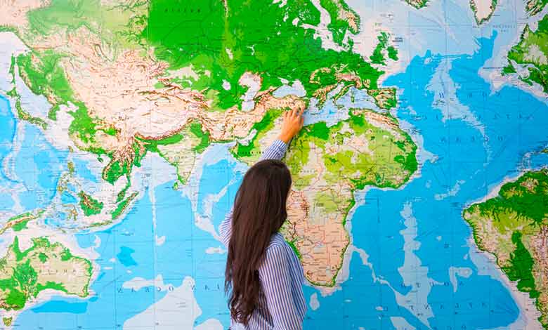
Study of physical geography
Location: Geographers locate places on Earth through two basic types of lines. The lines of latitude are also known as parallels that emanate from the equator. It is zero degrees and moves parallel toward the north or South poles. Any place can be located north or south of the equator between 0 and 90 degrees. On the other hand, longitude breaks up the planet in a circular way.
One meridian, called the prime meridian, is designated as zero. Also, it runs between the North Pole and the equator, bisecting Greenwich, England. There is another line that is 180 degrees. Any place on the planet is either east or west of that prime meridian.
They meet at a hundred and eighty degrees, on the other side of the planet, where the International Date Line is located. Time zones are based on lines of longitude. About every 15 degrees of longitude produces a new time zone.
Maps: Map scale determines how big a map is compared to the real world. There are a couple of ways to represent scale. The one that most of us prefer and are used to is the graphic scale. It shows how many miles an inch covers. Geographers use a fractional scale instead, which shows what anything on the map represents in the real world. Maps are also projected from a spherical surface onto a flat surface, often distorting size.
All thematic and topographic maps help us symbolize the real world. Topographic maps use little brown lines called contour lines to see the shape of the Earth’s surface. Geographic and spatial data are known as geographic information. It is projected through geographic information systems like Google Earth.
The focus on spatial patterns in the landscapes differentiates physical geography from other scientific fields. Physical geographers investigate the variation from place to place in the various spheres, their complex interaction, and how they change over time and across scales!
We’ve ventured through the processes that mold mountains, carve valleys, and dictate the ebb and flow of our oceans. This exploration into the physical geography of our Earth not only deepens our appreciation for the natural world but also underscores the importance of preserving these landscapes for future generations.
We hope this adventure has ignited a spark of curiosity within you, encouraging you to look at the world around you with new eyes, eager to learn more about the forces that shape our planet. Every hill, river, and desert tells a story; physical geography is the language to understand it. Until our next expedition into the wonders of our world, keep exploring, stay curious, and cherish the incredible planet we call home. Happy exploring, fellow geographers!
More Articles:
What Causes The Seasons To Change On Earth?
What Are The 5 Layers Of The Atmosphere?
References:
Pidwirny, Michael; Jones, Scott. “Physical Geography.”
Marsh, William M.; Kaufman, Martin. Physical Geography: Great Systems and Global Environments. Cambridge University Press.
“Physical Geography: Defining Physical Geography.” Dartmouth College Library.